 Sedona City Guide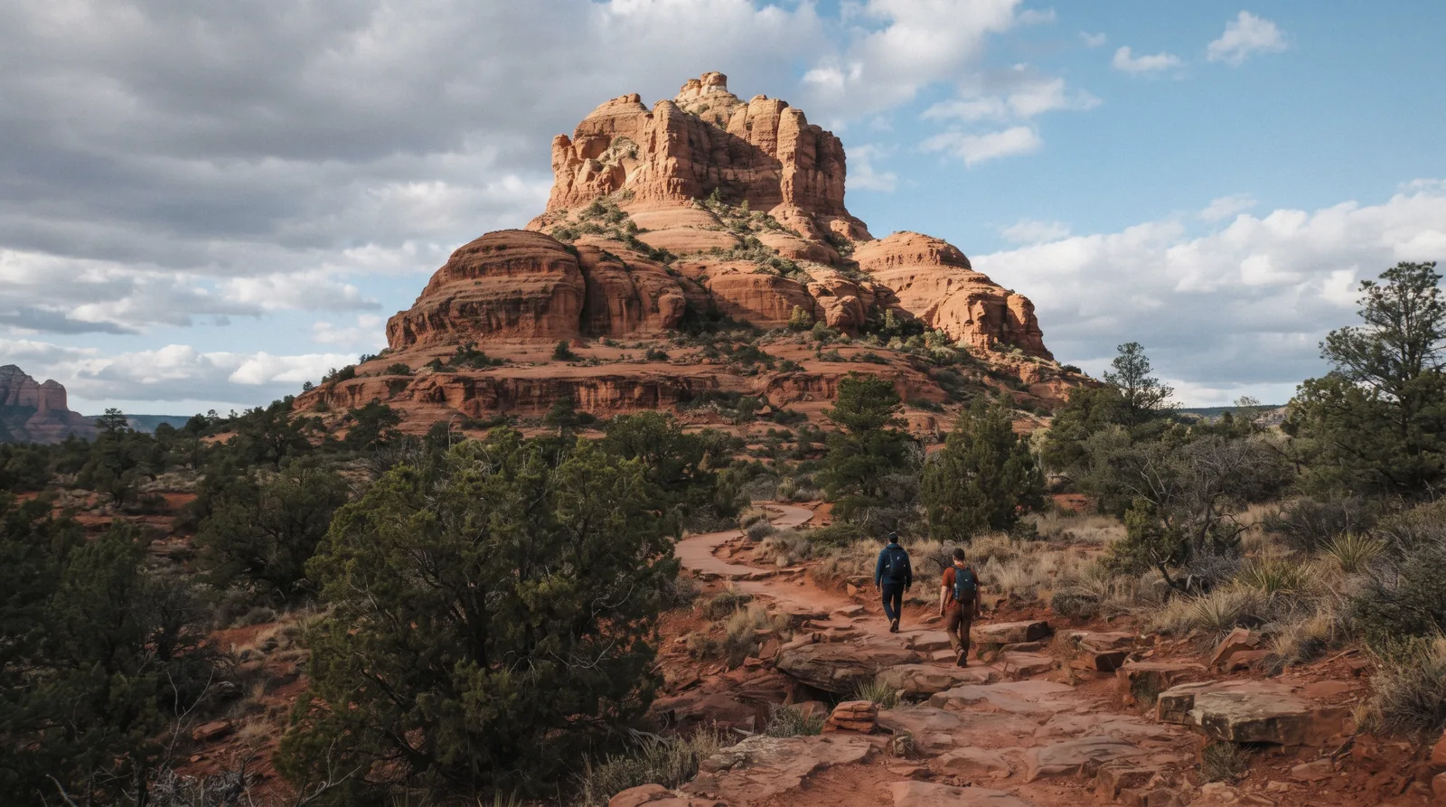
Bell Rock
Bell Rock is the bell-shaped red butte that sits right off Highway 179 between Sedona and the Village of Oak Creek, and it is the single most-photographed formation in the Coconino National Forest; you see it from the highway before you see anything else. Two named trails wrap around it and its neighbor Courthouse Butte: the paved-then-slickrock Bell Rock Pathway that most visitors walk partway up, and the full Courthouse Butte Loop that circles both formations. This page covers the trail lengths, the parking lot and the pass it needs, the honest limit of the informal "climb," and the vortex claim people search for. Where to eat, sleep or find the full trail list for the rest of Sedona lives on things to do in Sedona and the hiking trails hub. What a full Sedona visit adds up to beyond this one formation starts on the homepage.
Quick answer Trail lengths, the pass, the climb limit, in three lines
Bell Rock Pathway runs 3.5 miles one way from the Bell Rock Vista lot, an easy walk on a wide hard-packed surface; the Courthouse Butte Loop around both formations is 3.8 miles roundtrip and rated Moderate. Both trailheads need a $5 Red Rock Pass.
Key takeaways
- Parking at either the Bell Rock Vista or Courthouse Vista lot needs a Red Rock Pass ($5/day); no shuttle serves this trailhead, unlike Cathedral Rock
- There is no maintained route to a Bell Rock summit; the Forest Service trail stops on a lower shelf, and the scrambling above it is unofficial and exposed
- A guided vortex jeep tour drives the base and stops for the climb with a spotter, which is the easiest way to try the scramble without going alone
Key facts
Opening hours
| Coconino National Forest land | Open 24 hours–no gate |
|---|
Closed Not stated; occasional temporary closures during wildfire fire restrictions or forest orders
Admission
- Adult
- $5 per vehicle per day, $15 weekly or $20 annually for a Red Rock Pass at the trailhead kiosk
- Reduced
- America the Beautiful / Interagency Annual Pass accepted in place of the Red Rock Pass
- Free
- No fee to walk in on foot or bike from outside the fee boundary; the trail itself has no ticket
Planning it
- Time needed
- Forest Service figure: about 2.5 hours roundtrip on the Pathway or the Loop; our routing: 45 minutes for the paved approach alone, half a day if you add Courthouse Butte and a photo stop
- Book ahead
- Optional — walk-up usually fine
- Address
- Bell Rock Vista Trailhead, SR-179 mile marker 302, Sedona, AZ 86351 (south end); Courthouse Vista Trailhead, SR-179, Sedona, AZ 86351 (north end)
Bell Rock sells no ticket; the money question here is parking. Three ways to get a car (or yourself) to the base, compared from the Forest Service Red Rock Pass program and the two Sedona tour operators whose routes stop here, checked in Q3 2026.
Driving yourself and parking at the trailhead, or letting someone else handle the pass and the driving?
| Option | Cost | Gets you | Cancel | Book |
|---|---|---|---|---|
| Red Rock Pass, Bell Rock Vista or Courthouse Vista lotAnyone with their own car and no interest in a guide | $5/day, $15/week, $20/year | A marked parking space at either trailhead; buy at the kiosk or online | Not applicable; day pass, no booking | Official site |
| America the Beautiful / Interagency Annual PassVisitors already holding the federal pass for national parks elsewhere on the trip | $80/year, covers hundreds of federal sites | Same lot as the Red Rock Pass, no extra fee here | Not applicable | Official site |
| Guided Vortex Jeep Tour, stops at Bell RockRiders who want Bell Rock as one stop inside a wider vortex-site loop | From $123.86 | Driver, parking handled, a guide's take on the vortex claim | Free up to 24 hours before | Check Availability |
| Touch the Earth Pink Jeep Vortex TourVisitors who want the branded Pink Jeep experience over a generic operator | From $142.42 | Pink Jeep's own vortex route, Bell Rock included | Free up to 24 hours before | Check Availability |
The Forest Service runs the only official fee here; both tour rows carry their own transportation and parking, so their price replaces the $5 pass rather than adding to it. Prices as listed on GetYourGuide in Q3 2026.
Bell Rock, guided
Every card below routes through Bell Rock as a stop; the operator's own page shows what else is on the loop. Prices in USD as listed in Q3 2026.
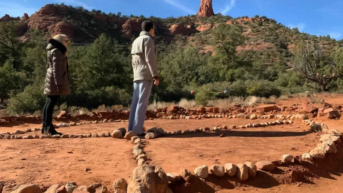 from $123.86
Sedona: Guided Vortex Jeep Tour
A Jeep ride to several vortex sites with time to walk around each one while the guide explains the local vortex lore. Suits visitors curious about the energy-site claims who still want a driven itinerary.
Check Availability from $142.42
Sedona: Touch the Earth Pink Jeep Vortex Tour
A vortex-themed jeep tour where the guide talks through the landscape's supposed areas of heightened awareness at a couple of stops. Suits visitors who want the vortex framing without leaving the vehicle for long.
Check Availability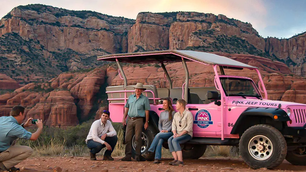 from $111.50
Sedona: Red Rock Range Pink Jeep Tour
A short Jeep run on mild dirt roads west of town to open panoramic viewpoints over Sedona's red rocks, including Thunder Mountain and Bradshaw Overlook. Suits first-time visitors who want scenery without a rough ride.
Check Availability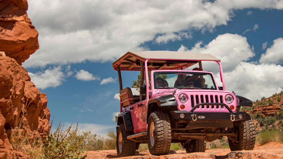 from $129.17
Sedona: Scenic Rim Pink Jeep Tour
A jeep run up toward the Mogollon Rim mixing high-desert forest with lowland views, built around photo stops rather than off-roading. Suits travelers who want more elevation and variety than a short in-town loop.
Check Availability from $175
Sedona: Vortex Tour with a Spiritual Guide
A private, on-foot vortex tour led by a self-described intuitive healing facilitator, built around the visitor's own intentions rather than a fixed script. Suits travelers who want a personalized spiritual session over a standard sightseeing stop.
Check AvailabilityPrices, ratings and details are the platform's own, checked in Q3 2026; dollar figures are the listed prices — the platform bills in your account's currency.
What Bell Rock and Courthouse Butte Are
Two formations, one trail system, both carved from the same rock the whole Sedona basin sits on.
A stepped butte of Schnebly Hill Formation sandstone
Bell Rock is a bell-shaped butte of red Schnebly Hill Formation sandstone, the same iron-oxide-stained rock that colors most of Sedona's named landmarks. The stepped, tiered look comes from harder and softer bands eroding at different rates, leaving the wide ledges that hikers use as informal rest stops on the way up. Courthouse Butte, its taller neighbor just east, has the same striped profile but a steeper, more vertical face with no informal route to the top at all.
Both sit inside the Coconino National Forest, off SR-179 between Sedona proper and the Village of Oak Creek, and both are visible from the highway before you reach either trailhead; Bell Rock is the shape most people mean when they say they can see Sedona from the car.
Two trailheads, one loop between them
The Bell Rock Vista Trailhead sits at the south end near the Village of Oak Creek turnoff; Courthouse Vista is the north trailhead, closer to the Village of Oak Creek's own retail strip. The Bell Rock Pathway (Trail No. 96) runs between the highway and the base of Bell Rock; the Courthouse Butte Loop (Trail No. 135) continues around both buttes and reconnects near either lot, so a single visit can start at one trailhead and finish at the other if a second car or a short highway walk is arranged.
Bell Rock Pathway Vs. The Courthouse Butte Loop
Both trails are officially rated by the Coconino National Forest; the figures below are its own numbers, read from the trail pages in Q3 2026.
The Pathway is the one almost everyone walks at least partway, because it starts flat and wide and only gets steep where people choose to leave it and scramble. The Loop commits you to the full circuit around both buttes, with more elevation change spread over a slightly shorter roundtrip distance.
| Trail | Distance | Elevation change | Rating | Time |
|---|---|---|---|---|
| Bell Rock Pathway (No. 96) | 3.5 miles one way | 185 ft | Easy, family-friendly | About 2.5 hours roundtrip |
| Courthouse Butte Loop (No. 135) | 3.8 miles roundtrip | 297 ft | Moderate | About 2.5 hours |
The Pathway is a wide, mostly hard-packed surface with some steep sections near the rock itself, which is why the Forest Service calls it family-friendly rather than flat. The Loop trades a similar time budget for more elevation change spread around the full circuit of both formations, plus longer stretches without direct highway sightlines; quieter, but less of a sure thing if you are short on daylight.
The Bell Rock Climb: What Is And Isn't Maintained
This is the fact most trip reports get vague about, so it gets stated plainly here.
There is no maintained Forest Service route to any summit of Bell Rock. The official Bell Rock Pathway ends at the base; above it, an unofficial scramble climbs the lower tiers on slickrock ledges and informal use-trails, and it is popular enough that a worn path is visible from the highway. That scramble tops out on a broad shelf roughly two-thirds of the way up the formation, well short of the true summit; the final pitch above that shelf is exposed Class 4 to low Class 5 climbing that the Forest Service does not sign, maintain or recommend, and every official source is silent on it rather than endorsing it.
People do go further than the shelf every year, and Sedona's search-and-rescue calls include falls from Bell Rock. If you are not comfortable down-climbing slickrock at an angle, the shelf is the sensible stopping point and it already gives the panoramic view most visitors are climbing for. Go up in the morning or evening when the rock is cooler and your shoes have more grip than on midday sandstone baked by full sun.
Is Bell Rock A Vortex Site
Bell Rock is one of the formations commonly named as a Sedona vortex site, alongside Airport Mesa, Cathedral Rock and Boynton Canyon. No government agency measures, certifies or maps a vortex; the claim is a belief associated with the site, not a physical reading anyone can point to on an instrument. What is verifiable is that people meditate, do yoga and take guided vortex walks here, and that the Forest Service manages the land the same way it manages any other trailhead; with a fee, a parking limit and a maintained trail, nothing more.
The full rundown of what the claim means and where it comes from is on the Sedona vortex sites page; a guided vortex tour is the way most visitors experience the idea rather than argue with it.
How Much Time To Give Bell Rock
Three routings, from the Pathway alone to the full loop with the scramble, timed against the Forest Service's own 2.5-hour figure for each individual trail.
Most visitors do not walk the whole Pathway. The short routing below covers what the photo-stop crowd actually does; the full loop and the climb-inclusive routing are for hikers with more time and daylight.
| Routing | What you get | What it skips | Time |
|---|---|---|---|
| The photo stop | First half-mile of the Pathway to the base, unobstructed views of the tiers | The rest of the Pathway and the Loop entirely | 20-30 minutes from the car |
| Pathway to the shelf and back | The full 3.5-mile Pathway plus the informal scramble to the shelf below the summit | The true summit pitch, which is unmaintained and exposed | 2.5-3 hours |
| Full Courthouse Butte Loop | The complete 3.8-mile loop around both formations, starting from either trailhead | The Bell Rock scramble itself, unless you detour for it | 2.5-3.5 hours |
Bell Rock In Dated Lines
A short history of the formation and the trail system around it, sourced to the Forest Service and the geology cited above.
-
c. 270-260 million years ago
The Schnebly Hill Formation is laid down
Wind-blown and stream-deposited sandstone accumulates across the Sedona basin; iron oxide staining later gives the rock its red color. Source: Coconino National Forest trail pages, read in Q3 2026.
-
Pre-1900s
Erosion carves the stepped tiers
Differential erosion of harder and softer sandstone bands produces Bell Rock's bell-shaped, terraced profile, the same process that shaped Courthouse Butte next to it.
-
20th century
The Coconino National Forest manages the land
Bell Rock and Courthouse Butte sit within the Red Rock Ranger District, administered from the Red Rock Ranger Visitor Center on SR-179.
-
2008
The Red Rock Pass fee program is formalized
The current $5/$15/$20 fee structure and trailhead list, including Bell Rock Vista and Courthouse Vista, is set under the Coconino Red Rock Pass program.
-
Ongoing
Bell Rock becomes Sedona's most-photographed formation
Its direct visibility from SR-179 and the informal climb to the lower shelf make it one of the most-visited trailheads in the Red Rock Ranger District, per the Forest Service's own trail listing.
Geologic dating and trail facts from the Coconino National Forest's Bell Rock Pathway and Courthouse Butte Loop trail pages, fs.usda.gov, read in Q3 2026.
Parking, The Shuttle Gap, And Village Of Oak Creek
The free Sedona Shuttle does not serve Bell Rock or Courthouse Butte; its routes cover Cathedral Rock, Little Horse, Soldier Pass and Dry Creek Vista/Mescal only, so there is no car-free alternative at this trailhead the way there is at those four. That means the Bell Rock Vista and Courthouse Vista lots fill on their own on weekend mornings with no overflow shuttle to fall back on.
The Village of Oak Creek, the community just south of the Bell Rock Vista lot, is the closest place to stay if you want to walk or drive two minutes to either trailhead before the lot fills; the Village of Oak Creek neighbourhood page covers lodging in the area. If both lots are full, the honest options are to come back at a quieter hour, or take a guided jeep tour that parks on its own permit.
- No Sedona Shuttle route to Bell Rock or Courthouse Butte
- Bell Rock Vista lot: south end, closest to Village of Oak Creek
- Courthouse Vista lot: north end, closer to central Sedona
- Full parking guide for Sedona covers every other lot in town
At Bell Rock: What To Do, And What Not To
Compressed from the sections above into the decisions that matter on the morning you go.
Do
- Buy or display a Red Rock Pass before you park; the kiosk checks both lots
- Go early or late for cooler rock and better grip if you plan to scramble above the Pathway
- Stop at the shelf below the summit if you are not comfortable down-climbing slickrock
- Pick Bell Rock Vista if you're staying in Village of Oak Creek, Courthouse Vista if you're coming from central Sedona
- Carry more water than feels necessary; there is no shade and no water source on either trail
Don't
- Don't expect a shuttle here; unlike Cathedral Rock, private cars are the only way in
- Don't push past the shelf without climbing experience; the final pitch is unmaintained, exposed rock
- Don't park outside the fee lots on the highway shoulder; it draws a citation and there is no safe walking margin
- Don't confuse the Pathway (Easy) with the Loop (Moderate) when planning your time budget
Five Things Most Visitors Do Not Know About Bell Rock
All five change something practical about the visit.
- There is no shuttle here. Every other major trailhead in the Sedona shuttle system; Cathedral Rock, Soldier Pass, Dry Creek Vista; has a free alternative to parking; Bell Rock does not [sedonashuttle.com route list, read in Q3 2026]. - The Red Rock Pass is required at both trailheads, not just one. Bell Rock Vista and Courthouse Vista are both on the Forest Service's named fee-site list, so parking at either lot without a pass or an America the Beautiful pass risks a citation [Coconino National Forest Red Rock Pass program page]. - The Pathway and the Loop are separately rated trails with different numbers, not two names for the same walk: 3.5 miles one way, Easy, versus 3.8 miles roundtrip, Moderate [fs.usda.gov trail pages]. - The scramble above the Pathway is not an official trail at all. No Forest Service page describes, times or maintains a summit route; what exists is a worn use-trail the agency neither signs nor recommends. - Bell Rock is one of four commonly named vortex sites, but the claim itself is never an official designation anywhere in the Forest Service's own trail description; the land is managed exactly like any other trailhead [Coconino National Forest trail page, cross-checked against the vortex claim's absence from any official source].
Bell Rock Map: Trailheads And What's Nearby
The two trailheads that bracket Bell Rock and Courthouse Butte, plus the nearest neighbourhood and the next vortex site.
Next Stop From Bell Rock
Walk and drive minutes are our estimates from the GPS distances.
Cathedral Rock
Sedona's other headline formation and the one the free shuttle actually serves. Cathedral Rock has a steeper, shorter trail and the same Red Rock Pass requirement.
10 min driveVillage of Oak Creek
The community just south of the Bell Rock Vista lot, with lodging closer to this trailhead than anything in central Sedona. Village of Oak Creek covers where to stay.
3 min driveRed Rock Pass
The parking pass every Bell Rock trailhead requires, with the full price list and every fee site it covers. Red Rock Pass page.
Buy before you arriveBell Rock Questions
How long does it take to hike Bell Rock?
The Forest Service rates the Bell Rock Pathway at about 2.5 hours roundtrip for the full 3.5-mile one-way trail, and the Courthouse Butte Loop at about 2.5 hours for its 3.8-mile roundtrip distance. Most casual visitors spend 20-30 minutes walking the first half-mile to the base and back. A guided vortex jeep tour covers the drive and a stop at the base in about two hours total.
Can you climb to the top of Bell Rock?
There is no maintained route to a true summit. An unofficial scramble on slickrock ledges reaches a broad shelf roughly two-thirds of the way up, which is where the Forest Service's own trail description effectively stops describing the route. The final pitch above that shelf is exposed climbing that no official source recommends.
Is Bell Rock in Sedona a vortex?
Bell Rock is one of the sites commonly named as a Sedona vortex, alongside Airport Mesa, Cathedral Rock and Boynton Canyon. No agency measures or certifies a vortex; it is a belief people associate with the formation, not a physical reading. The vortex sites page covers the claim and every named site in full.
Do I need a pass to park at Bell Rock?
Yes. Both the Bell Rock Vista and Courthouse Vista trailheads are on the Forest Service's Red Rock Pass fee list: $5 per day, $15 per week or $20 per year, sold at the trailhead kiosk, the Red Rock Ranger Visitor Center or online. An America the Beautiful / Interagency Annual Pass is also accepted. The Red Rock Pass page has the full list of sites it covers.
Is there a shuttle to Bell Rock?
No. The free Sedona Shuttle serves Cathedral Rock, Little Horse, Soldier Pass and Dry Creek Vista/Mescal only. Bell Rock and Courthouse Butte have no shuttle alternative, so both trailhead lots fill entirely from private cars; arrive early on weekends or book a guided tour that handles its own parking.
What is the difference between Bell Rock Pathway and the Courthouse Butte Loop?
The Pathway is a 3.5-mile one-way, Easy-rated trail that most people walk partway before turning back; the Courthouse Butte Loop is a 3.8-mile roundtrip, Moderate-rated circuit around both Bell Rock and its taller neighbor. Both take roughly 2.5 hours by the Forest Service's own figures, and they share the same two trailheads.
Where Bell Rock Fits In A Sedona Day
Bell Rock pairs naturally with Cathedral Rock as a two-stop morning; both are Red Rock Pass sites, both are on the SR-179 corridor, and Cathedral Rock adds the shuttle option Bell Rock lacks. If you're building a full day, the things to do hub ranks every attraction by time needed, and the hiking trails page lists every trail in the area with its own distance and difficulty rating. For a fixed itinerary, Sedona in 1 day and Sedona in 2 days both place Bell Rock in a specific slot rather than leaving it to chance.
Bell Rock On Film: The Pathway, The Climb And The Vortex Claim
Three walk-throughs that show the trail surface, the scramble line above the Pathway, and what the vortex visit actually looks like on the ground.
Bell Rock Hike - Sedona, Arizona
A full walk of the Bell Rock Pathway from the trailhead to the base of the formation.
Video: Magellan and GreyhoundHow to Climb the Official Bell Rock Climb in Sedona, AZ
The unofficial scramble route above the Pathway, shown step by step to the shelf below the summit.
Video: Live That AdventureBell Rock Vortex In Sedona, Arizona
A look at Bell Rock as one of Sedona's named vortex sites, filmed at the base of the formation.
Video: Roadside DiscoveryVideos load from YouTube only when you press play.
Reviewed Q3 2026 (July–September 2026); next review Q4 2026. Prices, hours and terms are set by the venue or operator and confirmed at checkout.
We may earn a commission if you book through one of our links, at no extra cost to you. Full affiliate disclosure