 Sedona City Guide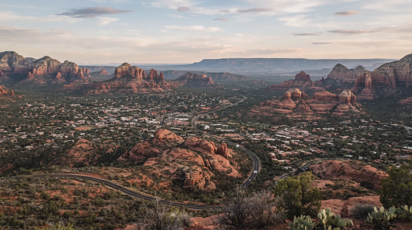
Sedona Map: Sights, Trails, Free Spots and Day Trips
This Sedona map puts every place this guide covers on one screen: the paid sights, the free spots, the trailheads, the shopping village and the eight day trips that leave town entirely, and it is what the guide this map sits inside points to whenever it names a place. Twenty-seven pins in five colours, filterable by category, each one linking to the page that explains its price and hours. The town itself is small and reads simply once you see it laid out. This page is that layout.
Quick answer How this Sedona map is organised, in three lines
Twenty-seven pins in five colours: terracotta for paid sights, juniper green for free spots, brown for trailheads, turquoise for the one shopping village on the list, and plum for the eight day trips that sit outside town.
Key takeaways
- Every pin links to the page that explains it; hours and prices live there, and the map repeats only what fits on a popup
- The eleven trailhead pins all need parking; most require a Red Rock Pass or the free shuttle when it is running
- The plum day-trip pins sit far outside this view on purpose: see the day trips index for the drive time to each one
How Sedona is laid out
Sedona runs along two highways that meet at a roundabout junction in Uptown: SR-89A comes in from the west through West Sedona and continues north through Oak Creek Canyon toward Flagstaff, and SR-179 runs south from that same junction through the Village of Oak Creek toward the I-17 interchange. Almost everything on this map sits within a few minutes of one of those two roads. There is no separate downtown grid to learn, just a long strip along 89A and a shorter one along 179.
Uptown, at the northern end where the two highways meet, is the one genuinely walkable cluster: the shops and galleries around North Highway 89A are close enough to park once and cover on foot, and the Sedona Heritage Museum and Chapel of the Holy Cross are a short drive rather than a walk from there. West Sedona, the stretch of 89A running west from Uptown, is spread along the highway rather than walkable. Tlaquepaque, the Amitabha Stupa and most of the trailhead access roads branch off this section by car. South on SR-179 toward the Village of Oak Creek is where Bell Rock, Courthouse Butte, the Chapel access road and Red Rock State Park sit, all reached by car, not on foot from Uptown.
The five pin categories, at a glance
What each colour on the map costs and what it takes to park there, summarised from the pins above and checked in Q3 2026.
| Category | Pins | Typical fee | What you need to park |
|---|---|---|---|
| Sights | 3 | $10–$30, paid at a staffed gate | Pay on arrival; no pass covers these three |
| Free | 3 | None | Nothing: street or small lots |
| Trailheads | 11 | None at the trailhead itself | Red Rock Pass, Interagency Pass, or the free shuttle |
| Food & shops | 1 | Free to enter | Free on-site parking |
| Day trips | 8 | $10–$139 depending on destination | Varies: see each destination's own page |
Figures summarise the pins in the map above; the pin popups and each linked page carry the exact price.
What each pin colour means
Terracotta sights all charge a fee and all publish their own hours. The museum and the two state parks are the three on this map. Juniper-green free pins cost nothing to visit, though the Chapel and the Stupa are both donation-supported, not free in the sense of having no box to drop something in.
Brown trailhead pins are Forest Service land: no entrance fee at the trailhead itself, but a parking pass is expected at eight of the eleven, and the two state-park exceptions above are marked as sights rather than trailheads because their fee structure is different. Turquoise marks Tlaquepaque, the one shopping and dining village on this map, free to walk, with paid parking generally not enforced there. Plum marks the eight day trips that leave Sedona entirely; none of them is walkable from any other pin on this map, which is the whole reason they get their own colour and their own page.
The map
Twenty-seven pins, filterable by category: sights, free spots, trailheads, food and shops, and day trips. The list below the map repeats the same pins in text, grouped the same way. Every place links to its own page on this site and to Google Maps for directions. Checked in Q3 2026.
Sights 3 pins
- Sedona Heritage Museum$10 adult, under 13 freeOpen daily 11am-3pm
- Slide Rock State Park$20-$30 per vehicle, seasonalArizona State Park, own fee; Red Rock Pass not valid here
- Red Rock State Park$10 adult (14+)Arizona State Park, own fee; Red Rock Pass not valid here
Free 3 pins
- Chapel of the Holy CrossFree (donation-supported)Open 9am-4:45pm daily
- Amitabha Stupa & Peace ParkFreeGrounds open dawn to dusk
- Sedona Visitor CenterFreeOpen 8:30am-5pm daily, closed Christmas and Thanksgiving
Trailheads 11 pins
- Cathedral Rock Trail1.1 mi roundtrip, 669 ft gain, Strenuous; a rock scramble more than a hike
- Devil's Bridge Trail1.6 to 5.8 mi roundtrip depending on which of three trailheads you start from
- Bell Rock Pathway3.5 mi one way, Easy, wide hard surface
- Courthouse Butte Loop3.8 mi roundtrip, Moderate, shares the Bell Rock Vista trailhead
- Soldier Pass Trail4 mi roundtrip, 641 ft gain, Moderate
- Boynton Canyon Trail6 mi out and back, 931 ft gain, Moderately challenging
- Broken Arrow Trail1.5 mi one way to Chicken Point, Moderately easy
- Doe Mountain Trail1.3 mi roundtrip around the mesa rim, 542 ft gain
- West Fork TrailFirst 3 mi maintained and easy, 2-3 hours roundtrip; $15/day fee at Call of the Canyon
- Fay Canyon Trail2.1 mi roundtrip, 144 ft gain, Easy
- Airport Loop Trail3.5 mi full loop, 535 ft gain, Moderately challenging, circles Airport Mesa
Food & shops 1 pins
- Tlaquepaque Arts & Shopping VillageFree to walk the villageMon-Thu 10am-5pm, Fri-Sun 10am-6pm; over 50 shops and galleries
Day trips 8 pins
- Grand Canyon South Rim$35 per vehicleAbout 2h 20m one way, our estimate, off the edge of this view
- Antelope Canyon, Page$15/person + mandatory guideAbout 2h 45m one way, our estimate, well north of this view
- JeromeTown free; State Historic Park $10About 40 min one way over Mingus Mountain
- FlagstaffFree to walk; site fees $25-$35About 45 min one way through Oak Creek Canyon
- Montezuma Castle$10 adult, 7-day passAbout 35 min one way on I-17
- Tuzigoot$10 adult, same pass as Montezuma CastleAbout 30 min one way
- Palatki Heritage SitePass + Recreation.gov reservationAbout 40 min one way, partly unpaved
- Verde Canyon Railroad, Clarkdale$139 standard fareAbout 35 min one way
Sight, free and food-spot pins use each venue's own published address; trailhead pin positions are our own placement at each trail's main access point, since no Forest Service page publishes trailhead coordinates as text. Day-trip pins sit far outside Sedona itself: see day trips for drive times. Checked in Q3 2026.
Sedona Map: Questions
How many pins are on this Sedona map?
Twenty-seven: 3 paid sights, 3 free spots, 11 trailheads, 1 shopping village and 8 day trips. Filter by category with the chips above the map, or scroll the grouped list below it.
Why do the day-trip pins sit off the edge of the map?
The map is centred on Sedona itself so the eleven trailhead and in-town pins stay readable; the Grand Canyon and Antelope Canyon sit 100+ miles out. Zoom out to see them plotted, or use the day trips index for a map built at that scale.
Do the trailhead pins show parking fees?
Most Coconino National Forest trailheads on this map require a Red Rock Pass or the free Sedona Shuttle rather than a per-visit fee at the trailhead itself. Slide Rock and Red Rock State Park are the exceptions. Both are Arizona State Parks with their own per-vehicle fee, and the Red Rock Pass is not valid at either.
Is this the same map as the day trips page?
No. This map is centred on Sedona and its trailheads; day trips uses a wider map that fits all eight out-of-town destinations on screen at once, with our own drive-time estimate to each.
Can I get directions from a pin?
Yes: every pin's popup carries an Open in Google Maps link that starts navigation from your phone's current location. Pins with no separate page (a couple of the trailheads) still link to the hub page that covers them.
Sedona on Film: Getting Oriented
Three video walk-throughs of the town's layout and named areas.
Sedona Arizona Map Tour!
A drive-along tour naming the main roads and districts this map covers.
Video: Living in Northern ArizonaWhere to Stay in Sedona: Explore 4 Best Areas (with Map!)
A look at Sedona's areas from the angle of where a visitor bases themselves.
Video: MissTouristSedona Vortex Map - Location and Exploration
Context on the named formations this map plots alongside the trailheads.
Video: Southwest Media CommunicationsVideos load from YouTube only when you press play.
Reviewed Q3 2026 (July–September 2026); next review Q4 2026. Prices, hours and terms are set by the venue or operator and confirmed at checkout.
We may earn a commission if you book through one of our links, at no extra cost to you. Full affiliate disclosure