 Sedona City Guide
Sedona Hiking Trails
Coconino National Forest maintains eleven sedona hiking trails within a short drive of town, and this page, part of the wider Sedona guide this page sits inside, carries the Forest Service length, elevation gain and rated difficulty for every one of them, read in Q3 2026. They are grouped by what the walk actually asks of you, from the paved pathway at Bell Rock to the rock scramble up Cathedral Rock, and numbered to the pins on the map below.
Quick answer Eleven trails, four groups by difficulty, which ones need the shuttle
Coconino National Forest publishes a length and elevation figure for eleven trails around Sedona, from the 1.1-mile scramble up Cathedral Rock to the 6-mile out-and-back into Boynton Canyon. Four of them, Cathedral Rock, Soldier Pass, and the Mescal and Dry Creek Vista approaches to Devil's Bridge, are served by the free Sedona Shuttle because their own lots are small.
Key takeaways
- New to Sedona hiking, start with the paved Bell Rock Pathway or the 2.1-mile Fay Canyon Trail; both stay under 200 feet of elevation change.
- Want the view everyone posts, Cathedral Rock Trail climbs 669 feet in 1.1 miles over exposed rock and is rated Strenuous by the Forest Service, not a walk.
- Most trailheads take a Red Rock Pass at $5 a day; the exception is West Fork, where the fee is $15 a day and the pass does not work.
- Four Sedona trailheads run on the free Sedona Shuttle instead of a car; the alternative on a guided route is a wilderness hiking tour.
The 11 trails, grouped by what the walk asks of you
Length, elevation gain and rating are the Forest Service's own figures for each trail, read from fs.usda.gov in Q3 2026; sort by time or filter by the pass a trailhead takes using the chips. Every trail with a published GPS coordinate is numbered to the map.
Flat and paved
-
Bell Rock Pathway
Pathway from $5 Red Rock PassAbout 2.5 hr for the full 3.5-mile one-way path
A wide, hard-surfaced path the Forest Service rates Easy and family-friendly, running 3.5 miles one way past Bell Rock and Courthouse Butte with a few short steep sections.
Tip: Walk as little or as much as you want; there is no single loop, so turn around whenever the light or the crowd tells you to.
-
Fay Canyon Trail
Trail from $5 Red Rock PassNot stated by the Forest Service; our routing allows about 1 hour
2.1 miles roundtrip and only 144 feet of elevation gain, rated Easy, into a canyon below Bear Mountain with no dedicated page on this site yet.
Tip: The natural arch is a short unmarked scramble off the main trail near the canyon's end; most hikers miss the turn and walk past it.
A real walk
-
Soldier Pass Trail
Trail Not named in the Forest Service's own fee-site listAbout 2.5 hr roundtrip
4 miles roundtrip and 641 feet of gain, rated Moderate, past the Seven Sacred Pools and a sealed sinkhole; bikes are allowed only for the first 1.3 miles to the wilderness boundary.
Tip: The trailhead's own small lot is not on the Forest Service's standard pass-site list; once it fills, the free shuttle is the only way in.
-
Courthouse Butte Loop
Loop from $5 Red Rock Pass (Courthouse Vista trailhead)About 2.5 hr
3.8 miles roundtrip and 297 feet of elevation change, rated Moderate, circling Courthouse Butte from either the Courthouse Vista or the Bell Rock Vista trailhead.
Tip: Start from Courthouse Vista to the north if Bell Rock Pathway's lot is already full; both trailheads reach the same loop.
-
Broken Arrow Trail
Trail Not named in the Forest Service's own fee-site listAbout 1 hr to Chicken Point, 2.5 hr with the Submarine Rock spur
1.5 miles one way to the Chicken Point overlook, rated Moderately easy; the full loop out to Submarine Rock runs about 3.5 miles roundtrip with 344 feet of gain.
Tip: This is also the jeep-tour trail; walk it early on a weekday morning to have Chicken Point to yourself.
-
West Fork Trail
Trail from $15/day (up to 5 people), separate from the Red Rock Pass2 to 3 hr for the maintained first 3 miles
The maintained Call of the Canyon section climbs only 221 feet in its first 3 miles, thirteen creek crossings and red-walled canyon; the unmaintained continuation runs to 14 miles for experienced wilderness hikers.
Tip: This trailhead is a Forest Service concessionaire site: the Red Rock Pass is not valid here and the $4 walk-in rate only applies without a vehicle.
A scramble
-
Cathedral Rock Trail
Trail from $5 Red Rock PassAbout 1.5 hr roundtrip
1.1 miles roundtrip but 669 feet of gain, and the Forest Service describes it as more of a rock scramble over exposed slickrock than a hike; it is rated Strenuous, not Moderate.
Tip: This is one of the four shuttle-served trailheads; the small lot on Back O' Beyond Road fills within an hour of sunrise most of the year.
-
Doe Mountain Trail
Trail from $5 Red Rock PassAbout 1.5 hr for the full loop
0.7 miles of switchbacks to the flat mesa top, then a 1.3-mile roundtrip loop around the rim, 542 feet of gain, rated Moderately challenging.
Tip: The rim loop is flat once you're up; the climb itself is the only hard part, so turn back early if the switchbacks are too much.
-
Airport Loop Trail
Loop Not named in the Forest Service's own fee-site list2 to 3 hr for the full loop
3.5 miles circling the upper slope of Airport Mesa, 535 feet of gain, rated Moderately challenging, level for the first mile then a climb over basalt boulders.
Tip: This loop and the Airport Mesa vortex site share the same trailhead lot on Airport Road; it is one of the smallest paved lots in town.
A canyon day
-
Devil's Bridge Trail
Trail from $5 Red Rock Pass2 to 4 hr depending on the approach
The shortest way in, from the Dry Creek Road high-clearance trailhead, is 1.6 miles roundtrip with 371 feet of gain; from Mescal it is 4.0 miles, and from Dry Creek Vista via the Chuckwagon connector it is 5.8 miles, neither with a published elevation figure.
Tip: Mescal and Dry Creek Vista are both shuttle stops; only the short Dry Creek Road approach needs a high-clearance vehicle of your own.
-
Boynton Canyon Trail
Trail from $5 Red Rock PassAbout 2.5 hr one way, 5 hr roundtrip
6 miles out and back with 931 feet of gain, rated Moderately challenging, running between the Enchantment resort's canyon walls to a box-canyon dead end.
Tip: This is the longest trail on the list with no shuttle service; start before 8am in summer, since there is no shade until you are well inside the canyon.
Numbers match the list — tap a pin for the guide.
Eight trails compared: length, gain and what happens when the lot is full
Figures are the Forest Service's own for each trail, read from fs.usda.gov in Q3 2026. Surface and the lot-full column are our own reading of the same pages plus the Sedona Shuttle's published trailhead list; no agency states a vehicle-count trigger for any lot.
| Trail | Length | Elevation gain | Surface | If the lot's full |
|---|---|---|---|---|
| Cathedral Rock | 1.1 mi RT | 669 ft | Slickrock, hand-and-foot scramble | Shuttle from the Park & Ride, no reservation |
| Devil's Bridge | 1.6-5.8 mi RT (by approach) | 371 ft (short approach only) | Dirt track, sandy near the bridge | Shuttle covers the Mescal and Dry Creek Vista trailheads |
| Bell Rock Pathway | 3.5 mi one way | 185 ft | Hard-packed wide path | Not published; no shuttle covers this trailhead |
| Soldier Pass | 4.0 mi RT | 641 ft | Dirt trail, loose rock near the caves | Shuttle from the Park & Ride, no reservation |
| Boynton Canyon | 6.0 mi RT | 931 ft | Packed dirt, some sand | Not published; no shuttle covers this trailhead |
| Broken Arrow | 1.5-3.5 mi RT | 344 ft (full loop) | Slickrock and dirt, some 4WD road | Not published; no shuttle covers this trailhead |
| West Fork | 3-14 mi RT | 221 ft (first 3 mi) | Dirt path, 13 creek crossings | Not published; concessionaire lot, not on the shuttle |
| Doe Mountain | 1.3 mi RT (rim loop) | 542 ft | Switchback dirt climb, flat mesa top | Not published; no shuttle covers this trailhead |
"Not published" means no Forest Service or Sedona Shuttle page states what happens once a lot fills; drivers who arrive late at these five trailheads report circling for street parking or trying again later in the day.
The two guided hikes worth the price over a solo walk
Prices are the operator's own as listed on GetYourGuide in Q3 2026. Both cards take you to ground a solo hiker on the standard trails above cannot reach on their own.
 from $275
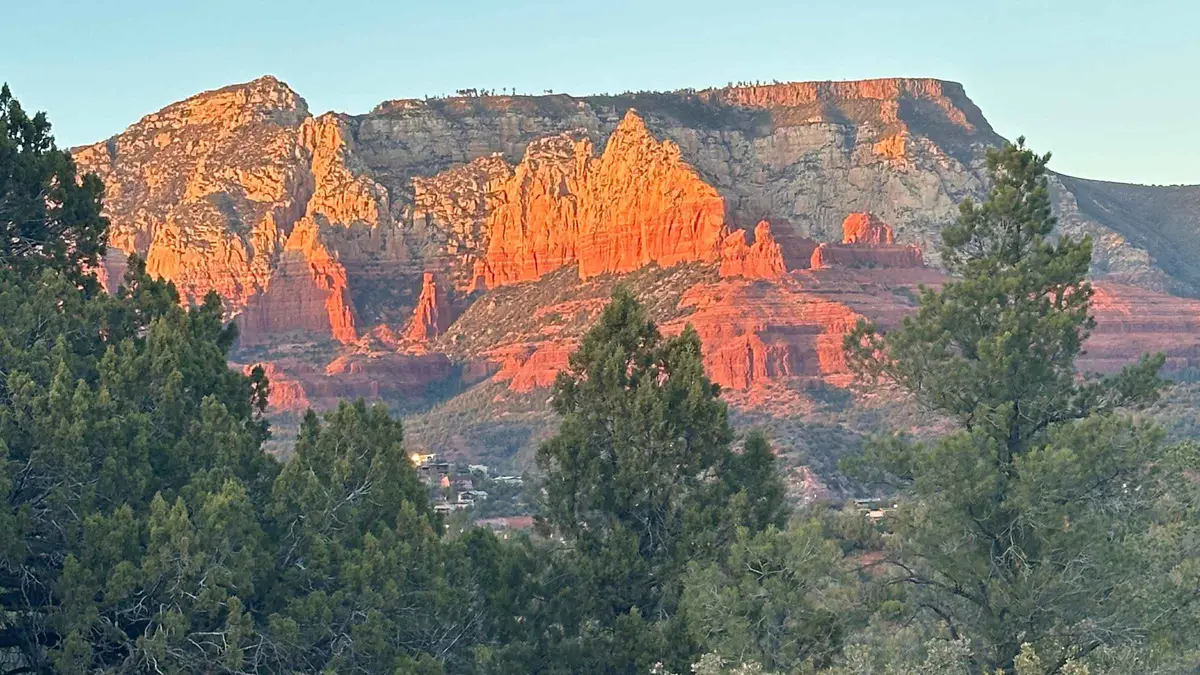
Sedona: Guided Wilderness Hiking Tour
A guided hike on off-the-beaten-path backcountry trails away from the busier named trailheads, aimed at travelers who have already done Cathedral Rock or Devil's Bridge. Suits repeat visitors who want less foot traffic over a bucket-list summit.
Check Availability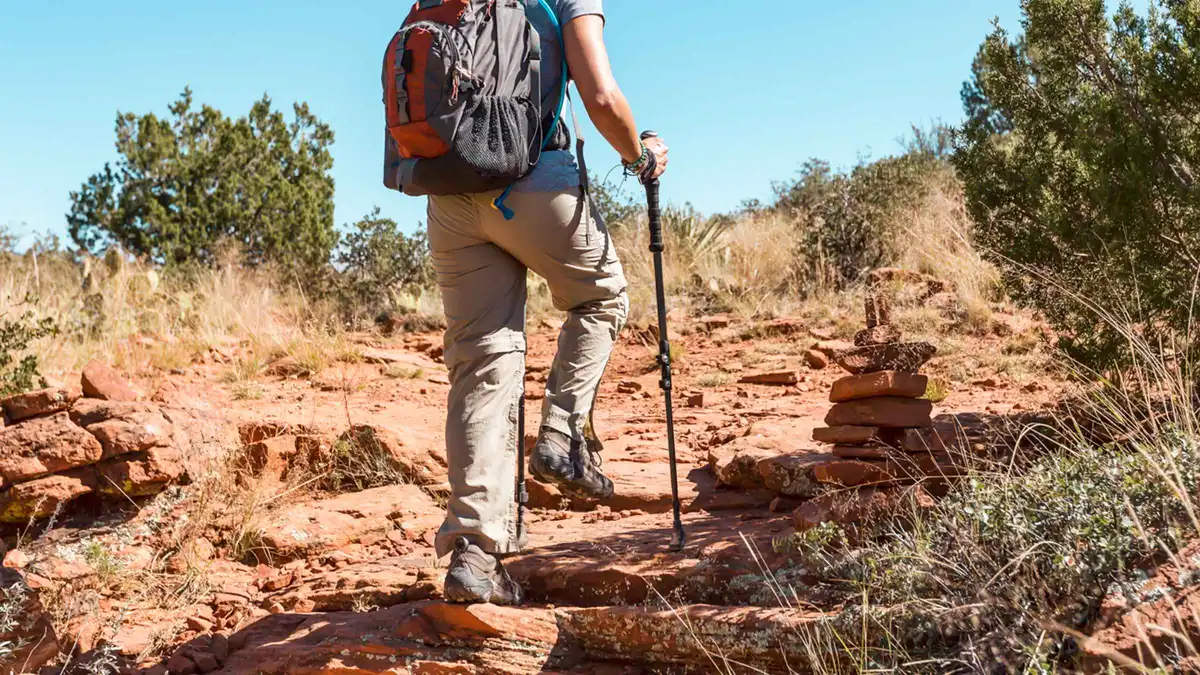 from $123.86
From Sedona: Archeology and Nature Hike
A Jeep ride to a private access point followed by a short, flat 2-mile hike to Native American ruins, positioned as an easier alternative to Palatki or Honanki. The same Sinagua-era dwelling style can be seen without a guide at Palatki Heritage Site, which requires a Red Rock Pass plus a free Recreation.gov reservation.
Check AvailabilityPrices, ratings and details are the platform's own, checked in Q3 2026; dollar figures are the listed prices — the platform bills in your account's currency.
Which trail for which morning
Eleven trails do not all suit the same day. This is a rough sort by what a morning actually allows.
A short first morning, before the day's real plan starts, fits Bell Rock Pathway or Fay Canyon Trail: both are under an hour and a half and neither needs a scramble. A photography morning wants Cathedral Rock or Doe Mountain for the climb to an open view, timed for the hour after sunrise when the light rakes low across the rock and the lot has not yet filled. A full day with lunch built in fits Boynton Canyon or the long approach to Devil's Bridge from Dry Creek Vista, both of which run three to five hours once the drive and the walk are added together.
A hot-afternoon fallback, when the exposed trails are unwise, is West Fork: its canyon walls and thirteen creek crossings keep the first three miles ten to fifteen degrees cooler than the open red rock.
If you only have one morning
Pair the Bell Rock Pathway with the Courthouse Butte Loop from the same trailhead cluster; together they cover 7.3 miles of the easiest ground on this list and put you within sight of four named rock formations without a single technical step. Our one-day Sedona itinerary builds a full morning around this pairing.
If a group has mixed ability
Broken Arrow splits cleanly at Chicken Point: the 1.5-mile out to the overlook is Moderately easy and turns back a group member who wants a shorter day, while the Submarine Rock spur beyond it adds real scrambling for anyone who wants more. The same trail is driven by the jeep tours that use it, so a hiker who arrives at Chicken Point on foot shares the overlook with vehicles for a few minutes at a time; arrive before mid-morning to miss the first tours out of town. Doe Mountain works the same way in miniature: the 0.7-mile climb to the mesa top is the only hard section, and anyone who stops there still gets the full 360-degree view without walking the flat rim loop beyond it.
The four shuttle trailheads, and what that means for a car
The free Sedona Shuttle serves Cathedral Rock, Little Horse, Soldier Pass, Dry Creek Vista and Mescal, running Thursday through Sunday, 7:00am to 5:30pm year-round, with a wait between pickups of 15 to 45 minutes depending on the route. No reservation is needed, both the Park & Ride lots and the ride itself are free, and the vehicles are wheelchair accessible with racks for up to three bikes. Of the eleven trails on this page, that covers Cathedral Rock outright and both the Mescal and Dry Creek Vista approaches to Devil's Bridge; Soldier Pass is served too, though its trail lies just past Little Horse on the same route.
What the Sedona Shuttle's own page does not state is whether the trailhead lots themselves are gated or physically closed to private cars while the shuttle runs; the page frames the shuttle as a free alternative to driving, not as a ban on driving. Treat the small lots at these four trailheads as first-come, first-served regardless of the shuttle, and plan on the Park & Ride if you are arriving after mid-morning. For the trailheads the shuttle does not reach, Boynton Canyon, Bell Rock, Broken Arrow, Doe Mountain, Fay Canyon and Airport Loop, a car and a Red Rock Pass are the only way in; our parking guide has the fill times we have observed by trail.
Heat, water and the monsoon window
The National Weather Service's HeatRisk scale runs zero to four rather than a single temperature cutoff, and its advice for outdoor exertion in Sedona is blunt: strenuous activity only between 4am and 7am, with one to two liters of water an hour outdoors after that. July averages a high of 91.5°F, and none of the eleven trails on this list has shade for more than a fraction of their length; West Fork's canyon walls are the one exception.
Arizona's monsoon runs a fixed calendar window, June 15 to September 30, busiest in August, and the National Weather Service in Flagstaff names Oak Creek and Sycamore Canyons directly in its flash-flood warning zones, warning of "raging killer currents possible in side canyons and narrow slot canyons." West Fork's thirteen creek crossings and Devil's Bridge's washes are both exposed to this; check the forecast the morning of, not the night before, and turn back at the first distant thunder. Our hiking safety guide has the full checklist for heat, water and monsoon timing across every trail on this page.
Where the Forest Service publishes no time, and what we allow instead
Nine of the eleven trails on this page carry an official Forest Service time estimate. Fay Canyon Trail is the exception: its page gives the length, 2.1 miles roundtrip, and the elevation gain, 144 feet, but no estimated walking time. Devil's Bridge's two longer approaches, via Dry Creek Vista and via Mescal, are the other gap: the Forest Service states the roundtrip mileage for each, 5.8 miles and 4.0 miles, but does not separately publish an elevation-gain figure for either, only for the short Dry Creek Road approach.
Where the source is silent, this page says so rather than printing a number as if it were official. Fay Canyon's "about 1 hour" above is our own routing at a typical walking pace on Easy-rated ground, not a Forest Service figure. The same applies anywhere else on this site a time or elevation figure is marked as our own estimate: the distinction is deliberate, and it is the difference between a number you can rely on for a booking and one you can rely on for a rough plan.
Buying the Red Rock Pass before you drive
A Red Rock Pass, or the federal America the Beautiful/Interagency pass, covers parking at the great majority of Coconino National Forest trailheads around Sedona, standard sites named on the Forest Service's own list at $5 for a day, $15 for a week or $20 for the year. Passes are sold three ways: online through Recreation.gov, at fee-machine kiosks at the recreation sites themselves, or in person at the Red Rock Ranger Visitor Center, 8375 State Route 179, Sedona (928-203-2900). Buying ahead online avoids a stop the morning of, since not every trailhead kiosk takes a card.
Five Coconino National Forest recreation sites sit outside this system entirely and need a separate Coconino Hospitality Annual Pass instead: Call of the Canyon at West Fork, Crescent Moon, Grasshopper Point, Beaver Creek Day Use and Lower Lake Mary. Of the eleven trails on this page, only West Fork falls in that group, which is why its $15-a-day fee above is not a typo next to the standard $5 Red Rock Pass rate on the other ten.
Beyond the trail list
Four pages this hub routes to before or after a day on the trails.
Vortex sites
Four of these same trailheads, Airport Mesa, Cathedral Rock, Bell Rock (via the Pathway) and Boynton Canyon, are also Sedona's four named vortex sites.
Same trailheads, a different reason to goRed Rock Pass
The $5/$15/$20 parking pass that covers most of the trailheads above, and the five it does not.
Buy before you drive, not at the trailheadParking in Sedona
Our own observed fill times for the busiest trailhead lots, separate from the official fee rules.
The practical half of this pageHiking safety
Heat, water, monsoon flash floods and what to carry, in one checklist.
Read before a summer trail on this listSedona hiking trails: questions
What is the most popular hike in Sedona?
By search volume and by tour bookings, Cathedral Rock and Devil's Bridge are the two most searched Sedona hikes, and both are on the shuttle-served list above. Cathedral Rock is shorter at 1.1 miles but rated Strenuous for the rock scramble; Devil's Bridge is longer but Moderate. Cathedral Rock's own page and Devil's Bridge's own page carry the full trail detail for each.
What are the easiest hikes in Sedona?
Bell Rock Pathway and Fay Canyon Trail are the two on this list rated Easy by the Forest Service, both under 200 feet of elevation change. Bell Rock Pathway is paved and wide enough for a stroller on the first stretch; Fay Canyon is a dirt path with no paving but no climbing either.
Do I need a permit to hike in Sedona?
No permit, but most trailheads need a parking pass: a $5 daily, $15 weekly or $20 annual Red Rock Pass, or the federal America the Beautiful pass. Our Red Rock Pass page lists which of the eleven trailheads on this page take the pass and which do not.
Which Sedona trails are served by the free shuttle?
Cathedral Rock, Soldier Pass, and the Mescal and Dry Creek Vista trailheads for Devil's Bridge, plus Little Horse, which has no dedicated page on this site. The shuttle runs Thursday to Sunday, 7am to 5:30pm, with no reservation needed; the full shuttle schedule is on our transport page.
How long does it take to hike Sedona's trails?
From 1 hour for Broken Arrow's short walk to Chicken Point to 5 hours roundtrip for Boynton Canyon, with most of the eleven trails on this page falling between 1.5 and 2.5 hours. The grouped list above carries the Forest Service's own time for each trail, or our own estimate where the Forest Service publishes none.
Can you hike in Sedona without a car?
For four of the eleven trailheads, yes: Cathedral Rock, Soldier Pass and both shuttle approaches to Devil's Bridge run on the free Sedona Shuttle from a Park & Ride lot in town. The other seven, including Boynton Canyon and Bell Rock, need a car of your own, or a guided wilderness hiking tour that provides the transport.
Sedona Hiking Trails on Film: Routes, Views and What to Skip
Three walkthroughs of the trails above, filmed by hikers who covered several of them in a single trip.
TOP 10 HIKES AND PLACES TO VISIT IN SEDONA, ARIZONA!
A ten-stop run through Sedona's best-known trails and viewpoints, useful for seeing the terrain before you pick a route.
Video: Kevin EassaWhich hike is the best? Sedona, Arizona - Rating 15 trails.
A hiker's own comparison across fifteen trails, rating each one for difficulty and view.
Video: Jerry ArizonaBest Hikes in Sedona | Our top 8 hikes while visiting
Eight trails covered on one trip, with the walking pace and footing shown for each.
Video: Tyler and KariVideos load from YouTube only when you press play.
Reviewed Q3 2026 (July–September 2026); next review Q4 2026. Prices, hours and terms are set by the venue or operator and confirmed at checkout.
We may earn a commission if you book through one of our links, at no extra cost to you. Full affiliate disclosure