 Sedona City Guide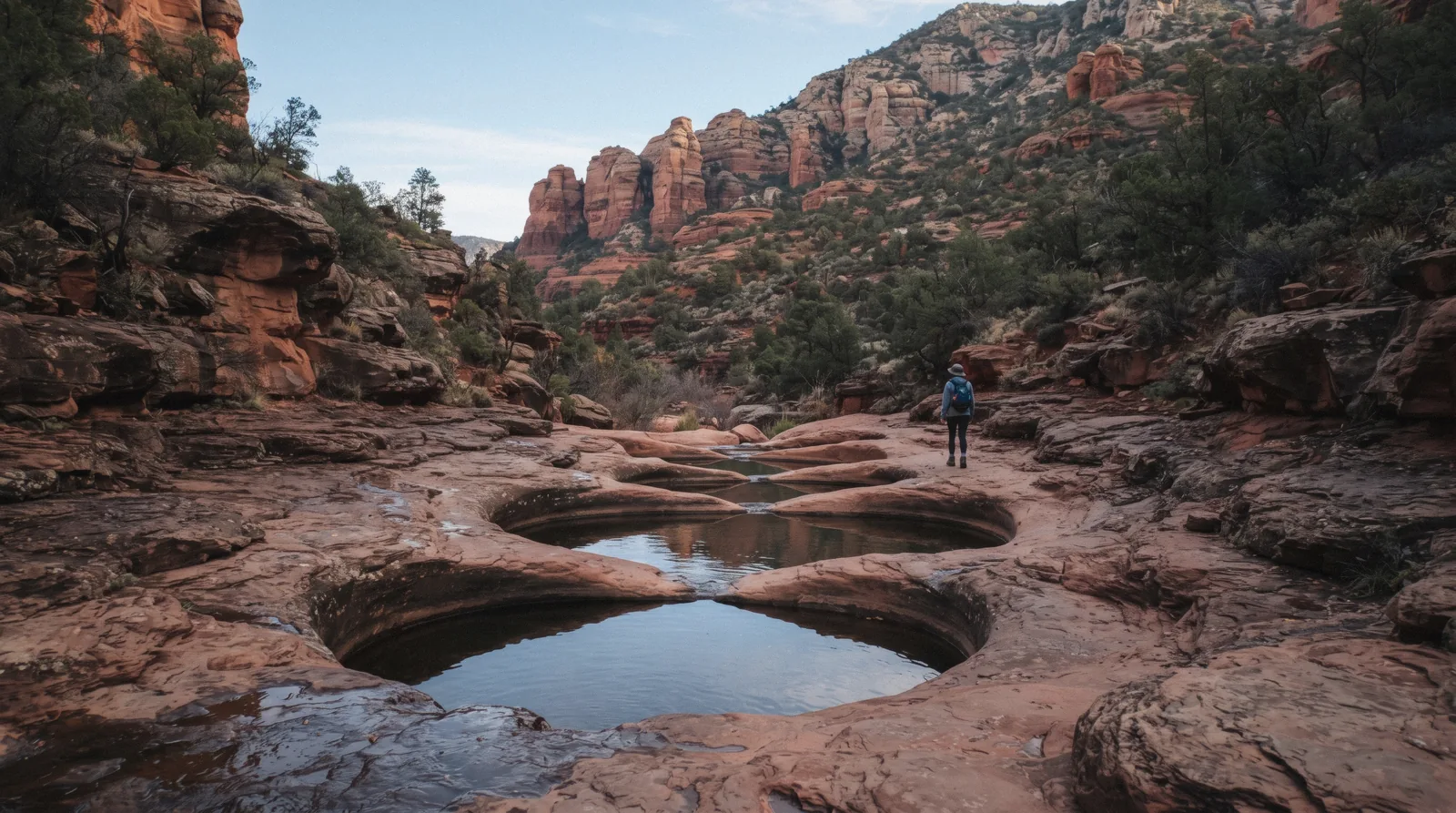
Soldier Pass Trail
Soldiers Pass Trail, Soldier Pass Trail No. 66 on Forest Service signage, climbs 4 miles roundtrip through a wash of eroded sinkholes and stone basins in West Sedona, past the sights that give it two of its owned keys, the sinkhole known as Devil's Kitchen and the row of potholes called the Seven Sacred Pools, before splitting toward an arch on one side and Brins Mesa on the other. This page covers the trailhead everyone gets wrong (a 14-space lot with a gate that locks at 6 p.m.), the sequence of features, why jeep tours share the first mile with walkers, and the cave nobody's official page will confirm. The full Sedona hiking trails list ranks every trail in town; the things to do hub covers everything else. The homepage's own ranking of which Sedona trail to pick first starts from there.
Quick answer Length, the 14-space lot, what's on the trail, and how to get in once it's full
Soldier Pass Trail runs 4 miles roundtrip with 641 feet of gain, rated Moderate by the Forest Service, about 2.5 hours out and back. Its own trailhead holds only 14 cars and the gate locks at 6:00 pm; once it's full, the free Sedona Shuttle is the way in.
Key takeaways
- The trailhead is not on the Red Rock Pass fee-site list, so parking itself is free, but there are only 14 spaces and no restroom, and the gate shuts at 6:00 pm sharp
- A private jeep tour covers the rough jeep road that shares this trail's first mile, for anyone who wants the Seven Sacred Pools view without the walk or the parking gamble
- The cave sold on postcards as Soldier Pass Cave is not on the Forest Service's own trail description at all; what the agency does confirm is the Devil's Kitchen sinkhole at a quarter mile and the pools just past it
Key facts
Opening hours
| Trailhead gate, all year | 8:00 am–6:00 pm |
|---|
Closed Not stated by the Forest Service page fetched for this guide
Admission
- Adult
- Free: no trail fee
- Reduced
- Not applicable
- Free
- The trail and the shuttle are both free; the trailhead lot itself is not on the standard Red Rock Pass fee list, so no per-vehicle charge applies there
Planning it
- Time needed
- About 2.5 hours roundtrip, the Forest Service's own figure for the 4-mile route
- Book ahead
- Optional — walk-up usually fine
- Address
- Soldier Pass Trailhead, off Soldier Pass Road, West Sedona, AZ
The three ways onto this trail, priced from the Forest Service's own trailhead page and GetYourGuide, read on 9 September 2026. Parking here costs nothing, but the lot is one of the smallest in Sedona; the free shuttle and a private jeep tour are the two ways around a full lot.
Are you walking in on your own two feet, or do you want a vehicle to cover the rough first mile for you?
| Option | Price | What it gets you | Best for | Book |
|---|---|---|---|---|
| Drive to the trailhead yourselfThe default, if you can be at the gate early | Free: this lot is not on the Red Rock Pass fee list | 14 spaces, no restroom or trash cans, gate open 8:00 am–6:00 pm | Anyone arriving before mid-morning | Official site |
| Ride the free Sedona ShuttleWeekend and holiday visitors: the shuttle exists precisely because this lot is undersized | Free, no reservation | Thursday–Sunday, 7:00 am–5:30 pm, 15–45 minute waits between pickups | Anyone arriving once the 14-space lot is gone | Official site |
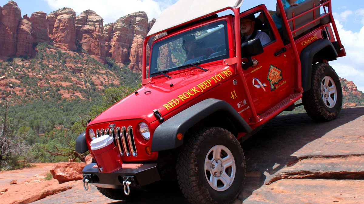
| Book a private jeep tour of the same routeAnyone who can't manage the loose rock underfoot, or who simply wants a guide | $159.95 | 2-hour guided ride up the jeep road that shares the trail's first mile | Visitors who want the pools view without the parking gamble or the walk | Check Availability |
The Forest Service confirms the fee status and the gate hours; the shuttle schedule is Sedona Shuttle's own published one; the jeep tour price is GetYourGuide's listed rate on 9 September 2026.
Soldier Pass, without the parking gamble
One operator runs this exact route by jeep; the price is GetYourGuide's own listed figure, read 9 September 2026.
 from $159.95
Sedona: Private Soldiers Pass Jeep Tour
A private 2-hour Jeep run through the Soldier Pass area with no other travelers in the vehicle. Suits couples or families who want their own pace and their own guide rather than joining a shared group.
Check AvailabilityPrices, ratings and details are the platform's own, checked in Q3 2026; dollar figures are the listed prices — the platform bills in your account's currency.
What's on the trail: the sinkhole, the pools, the fork, and the cave that isn't official
The Forest Service's own trail page lays the route out in order. Everything below the fork at 1.2 to 1.3 miles is the part almost every visitor walks; past it, the trail splits and most people never go beyond the first half.
Devil's Kitchen sinkhole, about a quarter mile in
The trail dips to cross a wash, then climbs to the Devil's Kitchen sinkhole just off the path to the right at about 0.25 miles. It's a collapsed limestone cavity, not a crater from an impact or an explosion as some retellings claim, and the Forest Service's own description treats it as a short detour rather than the main event. Most people glance in and keep walking; the sinkhole has grown gradually over decades as the underlying rock dissolves, and there's no fence or marker beyond the social trail worn to its edge.
The Seven Sacred Pools, another quarter mile on
After another quarter mile of level ground, a series of stone basins sits to the left of the trail: the Seven Sacred Pools that give this page its second owned key. They're carved into slickrock by centuries of monsoon runoff and hold water only after rain, so a dry spell before your visit means dry basins, not a broken promise. The name is a marketing invention, not a Forest Service one; the agency's own page never uses it, calling the feature only "the pools."
The wilderness boundary and the fork, 1.2 to 1.3 miles
At about 1.2 miles the trail crosses a jeep road, then forks near the wilderness area boundary at 1.3 miles. This is also where bicycles stop being allowed: the Forest Service permits bikes only for the first 1.3 miles, to this exact point, since the wilderness designation past it excludes wheeled and motorized travel entirely.
The right fork climbs steeply for a quarter mile to an arch with, in the Forest Service's own words, "great views." The left fork, and the main route most hikers take, continues toward Brins Mesa, reaching it at about 2 miles and meeting the Brins Mesa Trail a short distance further. Turning around at the mesa is what makes the round trip 4 miles; continuing on Brins Mesa Trail extends the day considerably and is a different hike, covered on the hiking trails list.
The cave the Forest Service does not mention
Soldier Pass Cave is one of this page's owned keys, and the honest answer is that the Forest Service's own trail description for No. 66 does not mention a cave at all. Not by that name, not by any name. What gets marketed online as Soldier Pass Cave is a rock alcove reached by an unmarked scramble off the maintained route, somewhere past the pools and before the fork, and no official Coconino National Forest page confirms its exact position, its distance from the trailhead, or even that the Forest Service considers it a named feature.
If you're chasing it, you're following a social trail and other hikers' directions, not a signed route, and this guide won't invent a mileage the agency itself doesn't publish.
How much time to give Soldier Pass Trail
The Forest Service publishes one figure for the whole out-and-back; these three routings are ours, built from where the trail actually forks.
The variable that decides your routing is the fork at 1.3 miles, not the total distance. Almost everyone who turns around early does it at the pools, well before the fork; almost everyone who goes the distance turns at Brins Mesa.
| Routing | What you get | What it skips | Door to door |
|---|---|---|---|
| The short loop | Devil's Kitchen and the Seven Sacred Pools, about a mile roundtrip | The fork, the arch and Brins Mesa entirely | 45 minutes to an hour, mostly flat |
| The full 4 miles | Everything to Brins Mesa and back, the Forest Service's own routing | The arch fork's steep quarter mile, unless you detour to it as well | About 2.5 hours, the Forest Service's stated figure |
| With a jeep | The private jeep tour runs the jeep road that shares the first mile | The wilderness section past 1.3 miles, which is closed to vehicles by definition | 2 hours, guided, no walking required |
The trailhead: 14 spaces, a locked gate, and the shuttle nobody mentions until the lot is full
Soldier Pass Trailhead sits off Soldier Pass Road in West Sedona, and the Forest Service's own page for it is blunt: "this trailhead only has 14 parking spots and no trash or restroom facilities." That is a small number for one of the busiest trailheads in town, and it is not padded by a Red Rock Pass overflow system the way Cathedral Rock's lot is. This site simply is not on the Coconino National Forest's standard fee-site list, so there is no pass to buy that guarantees you a space.
The gate itself is timed: open 8:00 am to 6:00 pm. Arrive before opening or plan to leave after closing and the issue isn't a full lot, it's a locked one. Nothing on the fetched Forest Service page states what happens to a vehicle left inside after the gate closes, and this guide won't guess.
Once the 14 spaces are gone, the free Sedona Shuttle is the documented alternative: Thursday to Sunday, 7:00 am to 5:30 pm, no reservation, a 15 to 45 minute wait between pickups depending on the route. Whether the trailhead's own small lot is physically gated to private cars while the shuttle runs is not something any Coconino National Forest or City of Sedona page confirms one way or the other. The shuttle is documented as a free alternative, not as a replacement for driving yourself. Treat that as an open question, not a settled rule.
- 14 parking spaces, no restroom, no trash cans
- Gate open 8:00 am to 6:00 pm
- Not on the Red Rock Pass fee-site list. No pass required, no pass helps
- Sedona Shuttle backup: Thursday–Sunday, 7:00 am–5:30 pm, free, no reservation
Why a jeep tour runs the same trail you're walking
The Forest Service's own warning for this trail reads: "the first half of this trail is often busy, and there is jeep tour and off-road vehicle traffic nearby." That traffic isn't trespassing. The jeep road that the trail crosses at about 1.2 miles is a legal vehicle route in its own right, and where the hiking trail and that road run alongside each other for the first mile, a licensed operator's private jeep tour is permitted to use it. Past the wilderness boundary at 1.3 miles, that changes completely: the wilderness designation excludes wheeled and motorized travel of any kind, which is also the exact point where the Forest Service stops allowing bicycles. A jeep can share the first mile with you; nothing on wheels goes past the fork.
What that means for a walker is mostly noise and dust on a busy afternoon, and for a rider it means the loose, rocky surface most hikers cross on foot without a second thought is the same surface the jeep is built to handle at low speed. If a crowded lot or the loose rock underfoot is the actual obstacle, not the walk itself, the jeep tour gets you to the same pools and the same views without either problem.
At Soldier Pass Trail: what to do, and what not to
Every line here is argued somewhere above; this is the version you can act on that morning.
Do
- Arrive at or before 8:00 am if you're driving. The lot has 14 spaces and no overflow system
- Check the Sedona Shuttle schedule before you drive if it's a weekend; Thursday–Sunday, 7:00 am–5:30 pm
- Turn around at the pools if you only have 45 minutes; that's the short version most people actually walk
- Wear shoes with grip past the fork. The surface toward Brins Mesa is loose and rocky, not packed dirt
- Book the private jeep tour instead if the parking gamble or the walk itself is the real obstacle
Don't
- Don't expect water in the Seven Sacred Pools after a dry spell. They fill from monsoon runoff, not a spring
- Don't leave a car past 6:00 pm; the gate is timed and this guide has no confirmation of what happens after
- Don't go looking for "Soldier Pass Cave" expecting a signed route. The Forest Service's own trail page never names it
- Don't ride a bike past the wilderness boundary at 1.3 miles; it's a Forest Service rule, not a suggestion
- Don't assume the jeep tour and the hiking trail overlap the whole way. Past the fork, vehicles are excluded entirely
Five things most visitors do not know about Soldier Pass Trail
All five come off the Forest Service's own trailhead page or the pass program it runs, each changing something practical about the visit.
- This trailhead is not on the Red Rock Pass list at all. Most Sedona trailheads charge $5 a day through the pass program; this one simply isn't in the standard fee-site list the Forest Service publishes, so no pass helps and none is required [fs.usda.gov Red Rock–Coconino Passes Program, read 2026-09-09]. - The lot has exactly 14 spaces. The Forest Service's own trailhead page states this directly, with no restroom and no trash service either, smaller than almost any other trailhead lot in West Sedona [fs.usda.gov Soldier Pass Trail No. 66]. - The gate has fixed hours: 8:00 am to 6:00 pm. This isn't a suggestion or a recommended window; it's the trailhead's own stated operating hours [fs.usda.gov Soldier Pass Trail No. 66]. - Bikes are legal for exactly 1.3 miles, then banned outright. The cutoff is the wilderness boundary, and the Forest Service names the distance precisely [fs.usda.gov Soldier Pass Trail No. 66]. - "Soldier Pass Cave" isn't in the Forest Service's own trail description. The agency's page covers the sinkhole, the pools, the fork and the arch, and stops there. The cave is a name that circulates on travel blogs, not on fs.usda.gov [fs.usda.gov Soldier Pass Trail No. 66, checked 2026-09-09].
Soldier Pass Trail map: trailhead, pools and next stops
The trailhead's small lot, the pools a half mile in, and the sights within a short drive.
Next stop from Soldier Pass Trail
Drive minutes are our estimates from the GPS distances between trailheads.
Devil's Bridge Trail
The Mescal and Dry Creek Vista approaches are also shuttle stops; the Devil's Bridge guide covers all three ways in.
About 8 min by carBoynton Canyon Trail
The longest maintained trail in this part of Sedona, with its own Red Rock Pass requirement and no shuttle service. Boynton Canyon guide.
About 10 min by carDoe Mountain Trail
A short, steep climb to a flat mesa top if the crowd or the parking here has worn thin. Doe Mountain guide.
About 12 min by carSoldier Pass Trail questions
How long does it take to hike Soldier Pass Trail?
The Forest Service states about 2.5 hours roundtrip for the full 4-mile out-and-back, 641 feet of elevation gain, rated Moderate. Many visitors turn around at the Seven Sacred Pools, about a mile in, which cuts that to 45 minutes to an hour. The private jeep tour covers the same first mile in about 2 hours without walking.
How difficult is Soldier Pass Trail?
The Forest Service rates it Moderate: 641 feet of gain over 4 miles roundtrip, with loose rock past the fork toward Brins Mesa. It is not the exposed rock scramble that Cathedral Rock is, but the surface underfoot is uneven enough that trail shoes with grip matter.
Where do you park for Soldier Pass Trail?
At the trailhead itself, off Soldier Pass Road, which holds only 14 vehicles and has no restroom. The gate is open 8:00 am to 6:00 pm. Once it's full, the free Sedona Shuttle runs Thursday to Sunday, 7:00 am to 5:30 pm, with no reservation needed.
Is there a fee or a Red Rock Pass required for Soldier Pass Trail?
No. This trailhead is not on the Coconino National Forest's standard Red Rock Pass fee-site list, so parking is free and no pass helps you get a space. The limit is the 14 spots, not a fee gate.
Where is Soldier Pass Cave and is it on the marked trail?
It is not on the Forest Service's own trail description for No. 66, which covers the sinkhole, the pools, the wilderness-boundary fork and the arch, and names nothing called a cave. What circulates online as Soldier Pass Cave is reached by an unmarked social trail, not a signed route, and no official page confirms its distance from the trailhead.
Can you bike Soldier Pass Trail?
Only the first 1.3 miles, to the wilderness area boundary. Past that point the Forest Service excludes bikes entirely, the same line where the jeep road also stops running alongside the trail.
Do jeep tours actually drive on Soldier Pass Trail?
On its first mile, yes: a jeep road crosses the hiking trail at about 1.2 miles, and a private jeep tour is permitted on that road. The wilderness boundary just past it excludes all vehicles, so nothing on wheels reaches the fork, the arch or Brins Mesa.
Where Soldier Pass fits in a Sedona day
Get to the trailhead by 8:00 am if you're driving yourself; the 14 spaces and the busy first half mile mean the gap between "plenty of room" and "full" is narrow. Walk to the Seven Sacred Pools and back if 45 minutes is all the morning allows, or push on to the fork and Brins Mesa for the full 2.5-hour round trip. If the lot is already gone when you arrive, the free Sedona Shuttle or the private jeep tour both solve the same problem from opposite directions.
One gets you there without a car, the other gets you there without walking. Boynton Canyon and Doe Mountain are both a short drive away for an afternoon second hike, and the full hiking trails list ranks everything else in town by difficulty and pass requirement.
Soldier Pass Trail on Film: Pools, the Cave, and the Jeep Road
Three walk-throughs that show the trail's actual surface, the pools after rain and the jeep road that runs alongside it, so the 14-space lot and the fork stop being an abstraction before you go.
Soldier Pass Trail: How to Find the Hidden Cave and 7 Sacred Pools
A hiker's route through the sinkhole and the pools, with the unmarked scramble some hikers take toward the cave.
Video: Live That AdventureTrail Guide: Soldier Pass Trail | Sedona, AZ (Seven Sacred Pools)
A straightforward trail guide covering the pools and the fork toward Brins Mesa.
Video: Emily PorterSoldier Pass Trail Sedona Arizona - Complete Permit and Gate Code Guide (Low-Moderate 4x4 Trail)
The jeep-road side of this trail, showing the vehicle route that shares the first mile with hikers.
Video: Trail TravelerVideos load from YouTube only when you press play.
Reviewed Q3 2026 (July–September 2026); next review Q4 2026. Prices, hours and terms are set by the venue or operator and confirmed at checkout.
We may earn a commission if you book through one of our links, at no extra cost to you. Full affiliate disclosure