 Sedona City Guide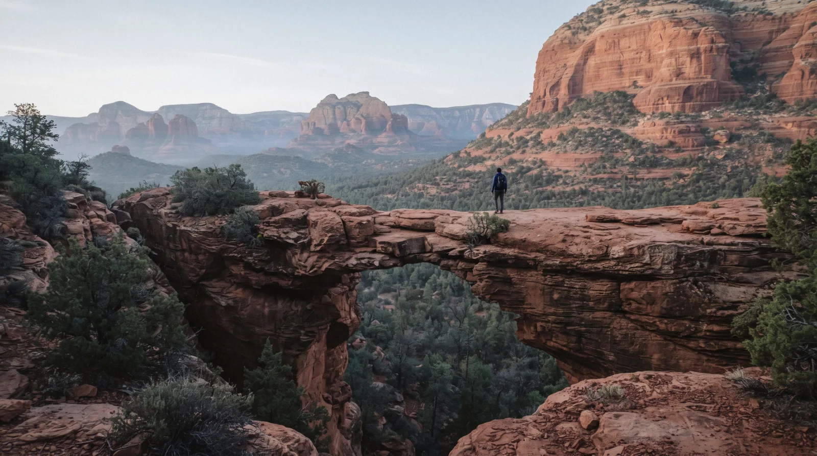
Devil's Bridge
Devil's Bridge, printed as devils bridge on the Forest Service's own trail signage and most maps, is Sedona's largest natural sandstone arch, and the single most-searched hike in town, reached by three different approaches that share the same final arch but not the same road, distance or difficulty getting there. This page separates the Dry Creek Road high-clearance approach, the Dry Creek Vista/Mescal trailhead, and the Chuckwagon route, because the road is the variable that decides most people's plan, not the walking itself. Pass and shuttle details are cross-checked against the Red Rock Pass and Sedona Shuttle pages; Cathedral Rock covers Sedona's other flagship scramble. How this one hike slots into a longer stay is worked out on the Sedona homepage's own trip-length planning.
Quick answer Three roads, three distances, one arch, pick the approach before you pick the difficulty
Devil's Bridge Trail No. 120 is 1.6 miles round trip with 371 feet of elevation gain only from the Dry Creek Road high-clearance trailhead nearest the arch. From the Dry Creek Vista/Mescal Park & Ride it's 5.8 miles round trip via the Chuckwagon connector, or 4.0 miles round trip from the Mescal trailhead directly. The Forest Service does not publish a separate elevation-gain figure for either of those two longer routes.
Key takeaways
- A standard rental car cannot make the last stretch of Dry Creek Road; if you don't have high clearance, park at Dry Creek Vista/Mescal instead or ride the free Sedona Shuttle
- A $5 daily Red Rock Pass covers the Dry Creek and Mescal trailheads; the informal Dry Creek Road pull-off nearest the arch is not on the Forest Service's named fee-site list
- The arch itself has a photo queue on weekend mornings; go at sunrise or, for a guided version with transport handled, book the Dry Creek Basin jeep tour or a guided wilderness hike
- It is not a place to be caught in a monsoon storm. See what goes wrong before a June–September visit
Key facts
Opening hours
| Year-round | Sunrise–Sunset (ungated Forest Service trail) |
|---|
Closed None published; the trail is not gated
Admission
- Adult
- Free to hike; $5 daily Red Rock Pass to park at the Dry Creek or Mescal trailheads
- Reduced
- $15 weekly or $20 annual Red Rock Pass; America the Beautiful / Interagency Pass accepted
- Free
- Arriving via the free Sedona Shuttle to Dry Creek Vista/Mescal needs no pass
Planning it
- Time needed
- Not stated by the Forest Service as a single figure since it depends on the approach; our routing: 1–1.5 hours from Dry Creek Road, 3+ hours from Dry Creek Vista
- Book ahead
- Optional — walk-up usually fine
- Address
- Devil's Bridge Trail No. 120: three trailheads: Dry Creek Road (high-clearance, nearest the arch), Mescal Trailhead, and Dry Creek Vista Park & Ride, all off Dry Creek Road, Sedona, AZ 86336
Devil's Bridge charges no entry fee; what you're really choosing between is which road gets you to which trailhead, and whether you drive yourself. Prices below are the Forest Service's own Red Rock Pass fees, the free Sedona Shuttle, and two guided alternatives, checked against fs.usda.gov, sedonashuttle.com and the operators' own listings on 9 September 2026.
Do you have a high-clearance vehicle, or are you starting from pavement?
| Option | Price | Covers | For whom | Book |
|---|---|---|---|---|
| Red Rock Pass: dailyDriving yourself to Dry Creek or Mescal trailheads | $5 per vehicle | Parking at the Dry Creek and Mescal trailheads for one calendar day | One-day visit | Official site |
| Red Rock Pass: weeklyA week or more in Sedona | $15 per vehicle | Same coverage, 7 consecutive days | Multi-day trips | Official site |
| Red Rock Pass: annualRepeat visitors and locals | $20 per vehicle | One calendar year of parking at standard fee sites | Return visits | Official site |
| Sedona ShuttleNo high-clearance vehicle, or no car at all | Free | A ride to the Dry Creek Vista/Mescal Park & Ride, Thursday–Sunday, 7:00am–5:30pm | Avoiding Dry Creek Road entirely | Official site |
| Dry Creek Basin jeep tourWanting the 4WD road handled by someone else | $149.95 | 2-hour off-road jeep tour through the Dry Creek Basin area | Skipping the drive, not the hike | Check Availability |
| Guided wilderness hiking tourWanting a guide on the trail itself | $275 | Guide-led hike on Sedona's backcountry trails | Company and route knowledge on the walk | Check Availability |
The America the Beautiful / Interagency Annual Pass is accepted in place of the Red Rock Pass. The primitive Dry Creek Road pull-off closest to the arch is not separately named on the Forest Service's fee-site list. Treat pass requirements there as unconfirmed and display a pass if you have one regardless.
Devil's Bridge: guided options
No operator sells a ticket specifically to Devil's Bridge; these are the closest guided ways in, linking to the operator's own page and live calendar. Prices in USD as listed on 9 September 2026.
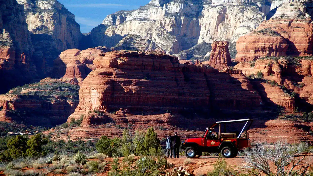 from $149.95
Most-reviewed private jeep tour on this page (135 reviews)
from $149.95
Most-reviewed private jeep tour on this page (135 reviews) From Sedona: Red Rock West Private Jeep Tour
A private off-road run through seven canyons to Dry Creek Basin, stopping at the historic Van Deren cabin site. Suits travelers who want a private 2-hour outing with a cowboy-history angle rather than the vortex or ruins themes.
Check Availability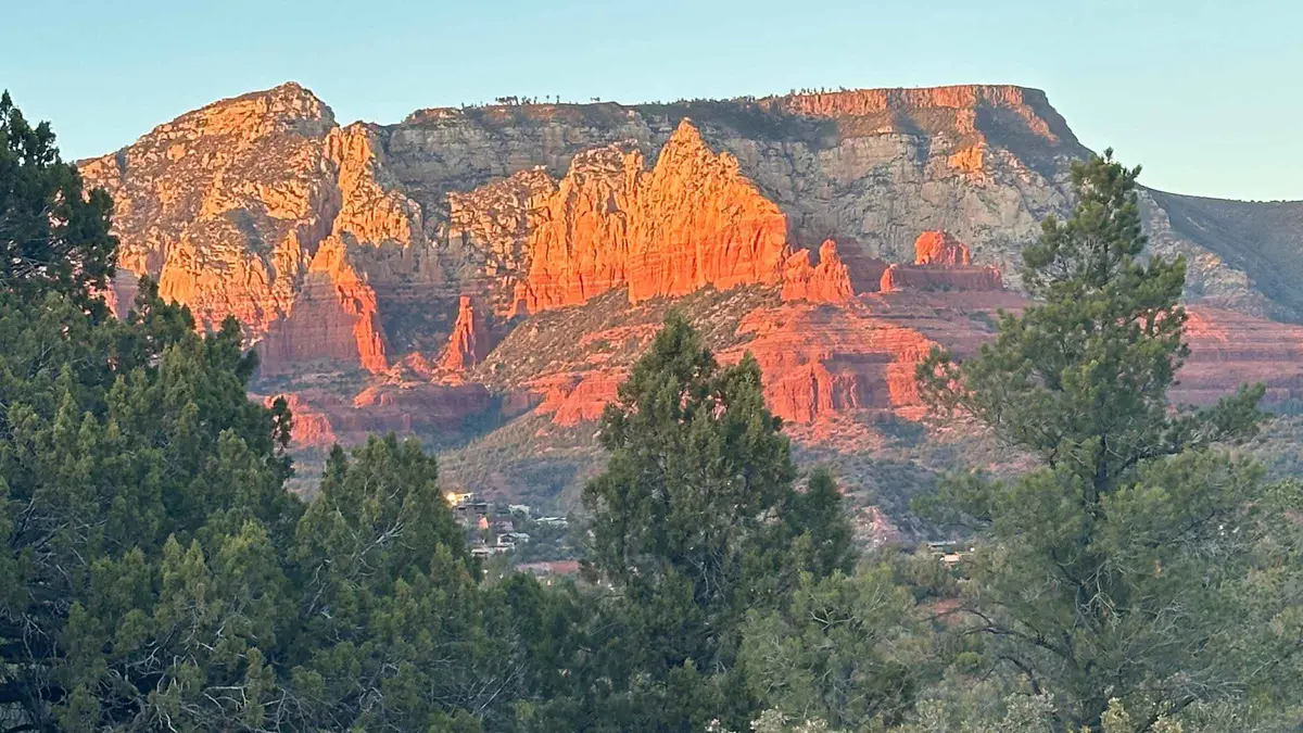 from $275
Sedona: Guided Wilderness Hiking Tour
A guided hike on off-the-beaten-path backcountry trails away from the busier named trailheads, aimed at travelers who have already done Cathedral Rock or Devil's Bridge. Suits repeat visitors who want less foot traffic over a bucket-list summit.
Check Availability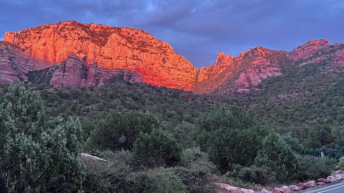 from $135
Sedona: E-Bike Sunset Tour Dry Creek area and Stupa
A paved e-bike route through the Dry Creek area to the Amitabha Stupa, combining a red rock ride with a stop most visitors otherwise drive to. Suits riders who want to see the Stupa as part of an active outing rather than a quick parking-lot visit.
Check AvailabilityPrices, ratings and details are the platform's own, checked in Q3 2026; dollar figures are the listed prices — the platform bills in your account's currency.
What Devil's Bridge actually is
Devil's Bridge is a freestanding natural arch of red sandstone in the Dry Creek basin northwest of Uptown Sedona, wide enough to walk across and tall enough that the crossing itself is the point of the hike, not just the view of it from below. It sits inside Coconino National Forest, reached from three different trailheads that converge on the same final approach to the span.
The Forest Service's own trail page for Devil's Bridge Trail No. 120 does not name the rock formation or print a geologic age for it, so none is given here rather than guessed. What it does confirm is the arch's setting: a mesa-top span in the Dry Creek drainage, reached by trail from three directions with no official ranking of one route over another beyond distance.
"Devil's Bridge" as a name is used for dramatic spans worldwide, and most carry a specific local legend explaining it. No Forest Service page or historical source we could fetch prints a naming legend for this particular arch, Wikidata's own disambiguation entry for the phrase (Q445800) describes it only as a pattern applied to bridges "built by or named after the devil," generally referring to old masonry bridges in Europe with a specific medieval story attached to each. This Sedona arch is natural, not built, and appears to simply carry the pattern's name without a documented story of its own.
Three approaches: the road, not the walk, is the difference
Distances and elevation gain from the Forest Service's own trail page for Devil's Bridge Trail No. 120, checked 9 September 2026. Only one of the three has a published elevation-gain figure.
All three approaches end at the same arch. What changes is the road you drive, the trailhead you start from, and, for two of the three, whether the Forest Service publishes an elevation-gain number at all.
| Approach | Round trip | Elevation gain | Road you need | Trailhead |
|---|---|---|---|---|
| Dry Creek Road (high-clearance) | 1.6 miles | 371 feet (only approach with a published figure) | High-clearance 4WD for the final stretch | A primitive pull-off nearest the arch |
| Mescal Trailhead | 4.0 miles | Not separately published | Standard vehicle, paved to the trailhead | Mescal Trailhead, Dry Creek Road area |
| Dry Creek Vista via Chuckwagon | 5.8 miles | Not separately published | Standard vehicle; this is the Sedona Shuttle's stop | Dry Creek Vista Park & Ride |
Devil's Bridge in dated lines
What is actually confirmed, and what isn't, about the arch's setting and the trail's regulation, checked directly against official pages on 9 September 2026.
-
1902
Sedona gets its name
The town's post office opens under postmaster T.C. Schnebly; his wife, Sedona Schnebly, gives the 55-person settlement its name.
-
1908
Coconino National Forest is designated
President Theodore Roosevelt formally establishes Coconino National Forest, the federal land that still contains all three Devil's Bridge approaches.
-
1988
Sedona incorporates
The City of Sedona becomes its own municipality, more than eight decades after the post office that named the town.
-
Not dated in any source fetched for this page
Trail No. 120 and its three approaches are formalized
The Forest Service assigns the trail its number and publishes distances for all three approaches, but not a year for when the Mescal and Chuckwagon routes were added or signed.
-
Not dated
Elevation gain is published for one approach only
The 371-foot gain figure exists only for the short Dry Creek Road approach; the Forest Service page does not explain why the other two approaches lack a published gain figure, or when that gap might be filled.
-
Not dated
The Red Rock Pass program and the Sedona Shuttle begin covering the Dry Creek and Mescal trailheads
Both programs apply today; neither program's own page states the year coverage of these specific trailheads started.
-
9 September 2026
This page's facts are checked
Every distance, elevation figure, fee and shuttle detail above was checked directly against the Forest Service trail page, the Red Rock Pass program page and sedonashuttle.com on this date.
Sources: en.wikipedia.org/wiki/Sedona,_Arizona; en.wikipedia.org/wiki/Coconino_National_Forest; fs.usda.gov/r03/coconino/recreation/trails/devils-bridge-trail-no-120; fs.usda.gov/r03/coconino/passes/red-rock-coconino-passes-program; sedonashuttle.com/trailhead-shuttles. All checked 9 September 2026.
The hike and the queue at the arch
Whichever trailhead you start from, the final stretch to the arch is the same: a sandy, rocky trail that climbs onto the mesa top where the span sits, with no shade for most of the approach. The arch itself is wide enough to walk out onto, and that single fact is why almost every visitor photo looks the same. Everyone is waiting for the same clear moment on the same narrow span.
No agency publishes a queue length or an average wait time at the arch, so any number you see quoted elsewhere is a visitor's own observation, not an official figure. What multiple trail reports agree on, and what our own check of the trail's popularity confirms, is that mid-morning through early afternoon on weekends is the busiest window; sunrise and late afternoon on weekdays are the closest thing to having the span to yourself.
There is no railing anywhere on the arch or its approach. The drop on either side is real, and the rock underfoot is the same exposed sandstone that makes Cathedral Rock's summit chute a scramble rather than a walk. Flat-looking from a distance, genuinely uneven up close.
Parking, the shuttle, and choosing your trailhead
If you're driving a standard rental car, choose the Mescal or Dry Creek Vista trailhead, not the Dry Creek Road pull-off. The Forest Service page does not print a distance figure for the unpaved portion of Dry Creek Road itself, only for the 1.6-mile trail once you're parked at its end, but the road's own reputation among Sedona's jeep-tour operators, several of whom run dedicated Dry Creek Basin routes, is the clearest signal that it demands real clearance, not just caution.
The Dry Creek and Mescal trailheads are both on the Forest Service's named Red Rock Pass fee-site list, so the standard $5 daily, $15 weekly or $20 annual pass covers parking there, as does the America the Beautiful pass. The primitive pull-off nearest the arch on Dry Creek Road itself is not separately named on that list. Display a pass if you have one, since the Forest Service's program is described as applying broadly across its recreation sites, but treat the specific requirement at that pull-off as unconfirmed rather than assuming either way.
The free Sedona Shuttle serves the Dry Creek Vista/Mescal Park & Ride Thursday through Sunday, 7:00am to 5:30pm, no reservation needed, wheelchair accessible, with racks for up to three bikes. That covers the two longer approaches (5.8 and 4.0 miles round trip) but not the short Dry Creek Road route. There is no shuttle service to the primitive pull-off nearest the arch, so choosing the shuttle means committing to the longer walk in exchange for not needing a high-clearance vehicle at all.
Devil's Bridge: what to do and skip that morning
The choice that matters most here is made in the parking lot in town, before you've driven a mile.
Do
- Check your vehicle's clearance rating before choosing the Dry Creek Road approach
- Start at sunrise if you want the arch itself without a photo line
- Carry 1–2 liters of water per person even though the short approach looks easy on a map
- Use the Sedona Shuttle to Dry Creek Vista/Mescal if you don't have high clearance
- Watch the sky from June through September and turn back before a monsoon storm builds
Don't
- Don't drive a low-clearance rental down the unpaved end of Dry Creek Road
- Don't stand right at the edge of the arch for a photo. There is no railing and no published height figure
- Don't assume all three approaches are the same length, they range from 1.6 to 5.8 miles round trip
- Don't expect shade anywhere near the arch itself
- Don't linger on the exposed mesa top if you hear thunder. There is no faster shelter nearby
Five things most visitors do not know about Devil's Bridge
Details that don't make it into the usual trail write-ups, each checked against an official page or source on 9 September 2026.
- The Forest Service only publishes an elevation-gain figure for the short Dry Creek Road approach, 371 feet over 1.6 miles round trip; the 4.0-mile Mescal and 5.8-mile Dry Creek Vista routes have no separately published gain figure. [fs.usda.gov, Devil's Bridge Trail No. 120, checked 2026-09-09]
- "Devil's Bridge" is a name pattern used for dramatic spans worldwide, most with a specific local legend attached. No Forest Service or historical page publishes a naming legend for this one. [Wikidata Q445800 disambiguation entry, checked 2026-09-09]
- The Forest Service page prints a distance for the trail once you're parked, but not for the unpaved stretch of Dry Creek Road itself that a high-clearance vehicle has to cover first. [fs.usda.gov, checked 2026-09-09]
- The free Sedona Shuttle covers two of the three approaches through the Dry Creek Vista/Mescal Park & Ride, not the primitive Dry Creek Road pull-off nearest the arch. [sedonashuttle.com, checked 2026-09-09]
- No agency publishes a queue length or wait time at the arch itself. Treat any figure you see elsewhere as a visitor's own observation, not an official number. [negative finding, checked 2026-09-09]
Devil's Bridge map: three trailheads, one arch
The three approach trailheads and the arch they share, checked against Forest Service and shuttle route descriptions on 9 September 2026.
Next stop from Devil's Bridge
Drive minutes are our estimates within the Dry Creek Road area.
Boynton Canyon
A longer, shaded canyon trail nearby, a good pairing if Devil's Bridge's exposed mesa top wasn't enough shade for the day. Boynton Canyon guide has trail distances.
About a 10-minute drive from the Dry Creek Vista areaDoe Mountain
A short, steep climb to a flat-topped mesa with wide views, close enough to combine with a Devil's Bridge morning. Doe Mountain guide covers the route.
About a 5-minute drive from the Dry Creek Vista areaWest Sedona
The nearest cluster of restaurants, gear shops and lodging to all three Devil's Bridge trailheads. West Sedona guide covers what's there.
About a 10-minute drive south on Dry Creek RoadDevil's Bridge questions
How long of a hike is Devils Bridge?
It depends entirely on which trailhead you start from: 1.6 miles round trip from the Dry Creek Road high-clearance pull-off, 4.0 miles from the Mescal Trailhead, or 5.8 miles from Dry Creek Vista via the Chuckwagon connector. See three approaches for the elevation gain each one carries.
What is the myth of the Devil's bridge?
No Forest Service page or historical source we could find publishes a specific legend for this arch's name. "Devil's Bridge" is a naming pattern used for dramatic spans worldwide, most tied to a European medieval legend about a bridge built with the devil's help. This natural sandstone arch appears to carry the name without a documented local story attached.
Is Devils Bridge a difficult hike?
The walking itself is moderate rather than a scramble, unlike Cathedral Rock's exposed chute. The real difficulty is choosing the wrong approach: the Dry Creek Road route needs a high-clearance vehicle, and the two longer approaches add several miles with no published elevation figure to plan against.
How much does it cost to go to Devil's Bridge?
The trail itself is free. Parking at the Dry Creek or Mescal trailheads needs a $5 daily Red Rock Pass (or $15 weekly, $20 annual), while the free Sedona Shuttle avoids the parking question entirely on the days it runs. See the full comparison above.
Which Devil's Bridge trailhead should I use?
If you have a high-clearance vehicle and want the shortest walk, Dry Creek Road's 1.6-mile round trip is the fastest option. If you're in a standard car, use Mescal (4.0 miles) or Dry Creek Vista (5.8 miles). The latter is also the only one the free Sedona Shuttle serves directly.
Do I need the Sedona Shuttle for Devil's Bridge?
Only if you lack a high-clearance vehicle and want to avoid the two longer walking approaches' own parking questions. The shuttle stops at Dry Creek Vista/Mescal, not at the primitive pull-off closest to the arch, so riding it means accepting the 4.0- or 5.8-mile round trip rather than the short 1.6-mile one.
Where Devil's Bridge fits in a Sedona day
Devil's Bridge works best as a morning anchor for the Dry Creek Road area, since Boynton Canyon and Doe Mountain sit close enough to combine into one loop without much extra driving. Choosing the approach first, based on what you're driving, decides the rest of the morning more than any other single choice on this page. A high-clearance vehicle buys back close to two hours compared to the Dry Creek Vista route.
For a fuller list of Sedona's numbered trails by difficulty, see Hiking Trails; Things to Do sequences this stop against the rest of town.
Devil's Bridge on Film: The Approaches and the Crossing
Three walk-throughs that cover different approaches and what the crossing itself looks like.
Devils Bridge Hike in Sedona, Arizona
A full walk-through of the hike to the arch and the crossing itself.
Video: Through My LensDevil's Bridge Sedona - The Better Way
A comparison of the approach routes and which one to pick.
Video: HikingGuy.comHow to Get to Devil's Bridge in Sedona, AZ
Directions and trailhead access for each of the three approaches.
Video: Live That AdventureVideos load from YouTube only when you press play.
Reviewed Q3 2026 (July–September 2026); next review Q4 2026. Prices, hours and terms are set by the venue or operator and confirmed at checkout.
We may earn a commission if you book through one of our links, at no extra cost to you. Full affiliate disclosure